Ancient roads
by Bethany M. Dunbar
September 11, 2009
Not all those who wander are lost.
The same could be said of the ancient roads of Vermont. Some of them are pretty darn close to lost, but if you look into the puckerbrush sometimes you can see where a log skidder scraped the bark off a big old tree down by the roots ten or 20 (or more) years ago, and there’s a mark knee-high because the tree has grown taller since then.
Ancient roads, Class IV roads, legal trails, paths and logging roads are wonderful for the places they lead to — sometimes just the middle of the woods. It’s usually a place where the overwhelming sound is crows gathering to migrate, or the humming crickets this time of year, and if you are lucky you might see a moose, a deer or a bear. The old roads are great for people who like hiking, horseback riding, cross-country skiing, snowmobiling and riding ATVs because there is little traffic but lots to see.
Ancient roads are troublesome for property owners who are trying to figure out if they own their land completely or if there is a right-of-way. This is particularly a problem if they want to sell their land. The state of Vermont has passed a law with a deadline for the ancient roads. Many of them are in the news more often these days.
According to the Vermont League of Cities and Towns newsletter, towns must add all ancient roads to town highway maps as Class IV roads or they might be reclassified as “unidentified corridors.”
If that happens, it becomes more difficult for the town to add an old road back to the map as a town highway. A hearing must be held, and affected property owners must be notified in writing 45 days in advance.
In Craftsbury recently, the selectmen decided they wanted to keep an old road despite an offer from a landowner — a controversial survivalist group called Mission New England — to swap the right-of-way for a large parcel of land, 83 acres.
An old road behind Norton Pond is the subject of a court case filed by someone who wants to be able to get to his house by driving over the old road instead of across the water.
I have posted two stories about these roads from the Chronicle below. Let me know your thoughts on these in the comment space. I have been wondering if towns are really going to be able to meet the deadline, if people are actually spending time of the town maps or old roads, and what is happening in various towns. If you have information, please let me know.
If you are reading from outside Vermont and plan to visit with a low-slung car, don’t trust your GPS. It might just send you out on a virtually non-existent ancient road and you will tear off your muffler.
But if you have the time to get out and walk, the old roads and trails are a wonderful way to get lost, or just to wander.

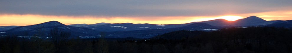
Hurricane Road Photo by Paul Lefebvre
The road home might be the Hurricane Road
by Paul Lefebvre
the Chronicle September 2, 2009
NORTON POND — A right of way issue that appeared to be resolved by a 2006 Supreme Court decision is turning into a protracted legal battle between the state and a homeowner here over what road he should be permitted to take home.
For the homeowner, the latest turn in the road battle across state land appears to be wearing thin.
“Everyone has the right to use the Hurricane Road except for me,” says David Berge, who maintains a year-round residence on the west side of the pond.
“I’m the only person they’re trying to stop from getting home,” he says, noting that hikers, bird watchers and sportsmen can come and go as they please.
Where they come and go to recreate is a large, and remote stretch of wilderness — 10,000 plus acres — known as the Bill Sladyk Wildlife Management Area. Off Route 114 about eight miles north of Island Pond, the area “ranges from Norton Pond northwest to the Canadian Border just north of Holland Pond,” according to a description from the Department of Fish and Wildlife, the state department that manages the property.
The state acquired the land, initially 7,001 acres, in 1959 from Florence Davis. At the time of the sale, she reserved roughly 38 acres on the west side of the pond, an area that came to be known as the Norton Pond Exclusion. The land changed hands again by the time Mr. Berge purchased two lots in 1997.
He accessed his property using the Hurricane Road, and for awhile, everything went along without any hassle. Then the state gated the road, denying him access across the WMA on grounds he could reach his property by water. A suit was filed, and a judge in Washington County Superior Court ruled in favor of the state, saying that because Mr. Berge had access to his property over water — Norton Pond — he could not claim he was entitled by necessity to have a right-of-access over the Sladyk WMA.
Mr. Berge appealed and the state Supreme Court heard the case during its March term in 2006. In what was regarded as a landmark decision — the high court ruled that when it comes to a right of way, water is no substitute for land. Writing for the majority, Justice John Dooley said that a right of way by water only is no right of way at all.
“We depend on roads and automobiles for transporting not only our family and friends, but all our basic necessities to and from our homes, and it is a quaint but ultimately pointless fiction to pretend that water — much less ice — represents a sufficient substitute.”
Justice Dooley went on to write that in today’s world people “think in terms of driving rather than rowing to work, home, or market.”
The decision was not unanimous. In a dissenting opinion, Chief Justice C. J. Reiber said the majority decision flew in the face of “our traditional adherence to necessity.”
After noting the remote location of the property, the chief justice argued that “water access may be very nearly as practical as the best reasonably available access by land.
“As plaintiff himself concedes,” Justice Reiber continued, “even his access via the claimed easement is highly weather-dependent and is not generally possible between late November and the time the Access Road becomes passable in the spring.”
But on the strength of the majority conclusion that “access to navigable water is generally not legally sufficient, standing alone, to defeat a finding of necessity,” the Supreme Court sent the case back to the lower court, where it has taken another tortuous turn.
On its web page, the Department of Fish and Wildlife says that the Sladyk WMA can be accessed either from the southeast on the Hurricane Brook Road or from the west on the Holland Pond Road. It’s an assertion that makes Mr. Berge’s blood boil.
When it comes to a passable right of way, he says, the Holland Pond Road is no option at all. The road has grown over so thickly, he adds, that not even a bicycle rider can get through.
The state begs to differ.
“We think Mr. Berge walked a route that we are not proposing,” says Jacob Humbert, the lawyer with the attorney general’s office who argued the department’s case before the Supreme Court.
The route of choice for Mr. Berge is the Hurricane Brook Road. It’s the road he was using before the gate went up, and it’s the road most frequently taken by people who drive into the Sladyk WMA.
“This is how the general public, of which the Plaintiff is a part, gets to and from the WMA,” writes Robert Gensburg, the St. Johnsbury attorney who represents Mr. Berge. “That is why the State acquired the right of way over Hurricane Road — so that the public could get to the WMA.”
The state’s signs along the road amplify the department’s intent in managing the WMA. “Camping allowed in designated areas only,’’ says one; another says camping is only allowed during hunting season. Clusters of black-eyed susans crowd either shoulder of the road, and every once in awhile a motorist can spot large, logging-size culverts that have been pulled and left unattended in an area honeycombed with roads, some barely passable.
A notice on an enclosed bulletin board proudly proclaims: “This Wildlife Management Area has been purchased with the goal of conserving wildlife and their habitat.” At the designated camping areas, there are outhouses wrapped in plastic coated wire to prevent bears and raccoons from clawing or chewing their way inside. A single fire pit circled with rocks suggests that few but the serious are inclined to camp here.
It may be that the state is relying on the high wilderness profile of the area to convince the court that the Hurricane Road should not exist as a private driveway for someone’s residence. From the beginning, the state and Mr. Berge have been at opposite, head-butting ends.
In an affidavit, dated in April, Mr. Berge says he has been using the Hurricane Road to access his property for 13 years. At some point, when the gate went up, he says he followed the instructions on the attached sign and applied for a key. The state, he recalls, said nothing doing.
Fish and Wildlife administrator Tom Decker provides a different account in an affidavit he submitted to the court in May. Mr. Decker, who wears the title, chief of operations for the department, says the gate was installed in 2000 after someone had dumped trash and stolen gravel from a gravel pit, along with disturbing a barrier that prevents beaver from plugging a culvert. Parties using the road were given 30 days to contact the department, and nothing more was done.
“The gate has been unlocked since that time and remains unlocked today,” he writes in his affidavit.
While the gate may no longer be an issue, the state’s resistance to Mr. Berge’s use of the Hurricane Road as a year-round access to his home has stiffened. At the core of its objection is an assertion that the road passes over property that is owned by a third party, and that is encumbered with a conservation easement that says the property cannot be used for non-forest purposes.
The third property owner goes by the name of Heartwood Forest Fund IV Limited Partnership. It acquired the property from the John Hancock Mutual Life Insurance Company, and that may be the only point where Mr. Berge and the state can find agreement. In the filings before the court, both sides have argued whether drafting errors occurred as the property went through changes of ownership from 1918 to the present, and whether a conservation easement has any bearing on the issue.
Mr. Humbert, the assistant attorney general who is arguing the case for the department, says that an easement from the Brown Paper Company in 1972 prevents any use of the road beyond recreational purposes in the WMA.
“Like the general public, Mr. Berge can continue to use the Hurricane Road to access the WMA for recreational purposes,” writes Mr. Humbert.
“But it does not follow that he can also be granted a private right of way along that route for year-round residential access to his property beyond the WMA.”
That logic has proven nettlesome to Mr. Berge and his attorney, who note that the third party, Heartwood, has agreed to grant the homeowner access over the road as long, that is, as the state agrees.
“There is no apparent reason, other than the State’s unreasonable (not to say obdurate) refusal to agree to a right of way from Heartwood, why the Plaintiff should not be able to drive his to home across the Hurricane Road if all the rest of the world can,” writes his attorney.
Perhaps because the issue is a legal one, there is no mention made of how much either access would cost, if either would be open to year-round travel. Each party says the other should bear the costs. Mr. Gensburg argues that the state’s proposed route, beginning at the western end of the WMA, would be a “redeveloped six-mile long road” that, he adds, would be “contrary to public policy.”
And he goes on to accuse the state of “using its monopolistic position to defeat the Plaintiff by locating the way of necessity on a route that can never provide practical access,” and would amount to a “disproportionately large amount of money” for his client.
“The state should not be allowed to do that,” writes Mr. Gensburg in his closing argument to the court.
In the state’s eyes, those arguments hold no weight when measured against protecting the land as a wildlife management unit.
“Heartwood’s grant of a right of way to Mr. Berge would constitute an exercise of development rights and a conversion to non-forest uses that extend beyond the allowable public access for dispersed recreational activities,” writes Mr. Humbert.
There is a fear, from the state’s point of view, that giving Mr. Berge access to his home over the Hurricane Road would upset the applecart of a conservation easement, and feasibly cost the state money to legally recover the damages.
An affidavit from Michael Fraysier, who is the head land administrator for the Department of Forests, Parks, and Recreation, says that allowing Mr. Berge to use the Hurricane Road to access his property would require amending an easement on roughly 31,000 acres that includes five towns and gores in northern Essex County.
“This is not a simple, straightforward action and is not something to be taken lightly,” say Mr. Fraysier, who warns that amending an easement would be costly, and might pave the way for other property owners following in Mr. Berge’s footsteps.
“The costs could be increased,” he writes if 15 other seasonal camp owners along the road, “want to increase their limited use to include year-round residential use.”
The state argues that it “has proceeded in good faith,” to explore other options with Mr. Berge. Options that the homeowner charges are useless.
“The proposed route will be unusable by vehicles throughout the spring, fall, and winter,” he says in his affidavit, characterizing the route as “an old, long-unused logging road.”
It’s a protest that falls on unsympathetic ears.
“The State should not be punished for the area’s existing geography between Mr. Berge’s property and the Holland town highway system,” notes Mr. Humbert.
A ruling on the dispute could come down as early as this month. Last week, according to Mr. Humbert, the court paid a site visit to the area.

Photo by Bethany M. Dunbar
Colburn Hill Road gate can stay
by Chris Braithwaite
the Chronicle, September 2, 2009
CRAFTSBURY — Mission New England can keep its gate at the end of Coburn Hill Road as long as remains unlocked, and people who open it and drive or walk another hundred yards or so are treated decently.
That was the gist of a motion passed by the Craftsbury Selectmen at their regular meeting Tuesday night.
It reversed an earlier decision, made after an ugly confrontation between mission members and a group of dirt bikers, to order the mission to take the gate down.
The selectmen made their decision over the strenuous objects of one of the dirt bikers, Jeff D’Amico of Wolcott. His objections were so strenuous, indeed, that at one point the board’s chairman, Bruce Urie, threatened to throw him out of Craftsbury’s town hall.
“The discussion is over,” Mr. Urie told Mr. D’Amico, banging his fist on the table. “If you open our mouth again, we’re asking you to leave.”
That came after Mr. D’Amico said he would exercise his right to use the public trail through the mission’s property by going up there every weekend and riding up and down the road past the gate four or five times.
“There’s a pissing match going on there,” said a disgusted Mr. Urie.
For his part, Mr. D’Amico said there should be no question that the gate must be removed and the town trail through the mission’s property marked for public use.
“You have a bunch of delusional people blocking off a road,” he said.
The mission was represented at the meeting by Roy Ward and R.C. Kirk, who let their lawyer, Steve Adler, do most of the talking for them.
They and the selectmen were able to agree that, at present, no one can exercise the right to use the right of way through the mission’s property, because nobody knows where it is.
Coburn Hill Road approaches the mission property from the south, and after it goes through the gate and runs a few hundred yards to the group’s collection of houses and barns, it disappears. The road was wiped out by floods in 1997, Mr. Urie said. But he has a clear memory of the old road, he added. “When I was a teenager we snowmobiled through there.”
The selectmen agreed to find out how much it would cost to have the old right of way surveyed, so it could be marked for the people who wanted to use it. Wayne Mutrux, a local surveyor who has made a study of old town records on the road, is willing to do the job, Mr. Urie added.
Besides Mr. D’Amico, two Craftsbury residents came to the meeting to say they would like to use the right of way.
“I used to ride my horse through there 20 years ago,” said Stacy Burke. Last summer, she said, she rode up to the gate, assumed it was locked, and turned around.
She met one of the group’s leaders, John Maniatti, on the way down Coburn Hill Road, she said. “He was very cordial. I said I would like to ride through. He told me the road had washed out. I said I’d like to try to go through.
“I would like to see it surveyed and kept open,” Ms. Burke told the selectmen. “It would be a good route for a lot of recreation — walking, riding horses, dirt bikes, anything.”
Ray Adams Jr. said the trail would provide a link to other dirt bike trails that go all the way to Lowell, via the Bayley-Hazen Road.
But until the trail is surveyed and marked, Mr. Adams told the selectmen, “there is no point in us being up there.”
“As a board,” said Selectman Susan Houston, “we should postpone any decision until we have the price and feasibility of the survey.”
In moving that the gate be permitted to stay, Selectman Jim Jones said his brother had received a cordial reception when he walked past the gate last week.
However, he said, “we have heard some complaints in the past about townspeople, including elected officials, getting harassed.
As part of his motion, Mr. Jones said the town would post a sign at the point where the town trail disappears, to the effect that the town is unsure where the right of way is, and visitors should please turn around.
The mission has tried for years to resolve the problem by having the town abandon the town trail once Coburn Hill Road crosses its property line. Its spokesmen asked about the mission’s offer to deed more than 84 acres of its property to the town, if it would throw up the trial.
That would be up to the voters, the selectmen said.
“You need to get five percent of the voters to sign a petition,” Mr. Jones said, to put the proposed deal on the Town Meeting warning.
Before the mission did that, Mr. Ward said, “we’d want to know if you’d be willing to support it.”
“The general feeling we got is that people do not like to give up rights of way,” Mr. Urie said.
If the mission sought the voters’ support, Mr. Jones added, “you’d have your work cut out for you.”
The selectmen did accept Mission New England’s invitation to hike the area of the lost right of way and the land that is on offer.
“It’s a nice hike,” said Mr. Ward. “Bring your boots.”
For more about this story, please check the Chronicle web site at www.bartonchronicle.com


Hi Bethany-
Nice work! There are old USGS topo maps that may be able to help with some of the location disputes. The Johnson Company uses these frequently to determine prior environmental conditions on properties. Also the Sanborn maps are incredibly detailed, and they go back to the late 1800’s (although that may not be far enough back in some of these places!). Keep up the good work!
Jim
This is fantastic. I have been reading your blog more than I ever actually read the Chronicle when it was online– please keep e-mailing me on Fridays after you post your next articles so I can keep up with the times!
Anyway, as for the articles: in the case of Mr. Berge it would seem that the State could reach a reasonable compromise allowing him to use the road on the condition that it remain publicly accessible as well (perhaps I am misinterpreting this — it sounds like he was trying to make the Hurricane road a private driveway? That seems irrational…). However, the question as to who would maintain it seems like the bigger question: If it were to be upgraded from the Class IV status it would require much more work: just imagine the Hinman road haha.
I love your comment about GPSs by the way. It’s too funny when we give people directions to Dad’s house with the specific instructions to disregard their GPS, but they still manage to find themselves facing the wild unknown beyond Blanche Perron’s place, wondering where they went wrong.
Thanks for keeping me in the loop,
~Katie
Hi Bethany:
This blog is a nice piece of work! It’s fascinating how “ancient” roads become contemporary vexations. I’m reminded, in another context altogether, that General George Patton advanced Third Army across France on the roads originally laid down by Julius Caesar figuring that if they were good enough for Caesar they would serve his purposes just as well. History shows they did: Third Army killed and captured more German combatants than any other Allied army, liberated more square miles of occupied territory than any other Allied army and accomplished all of the above while incurring the fewest casualties of any Allied Army in Europe. It is not commonly known that Caesar was a brilliant student of engineering. The Germanic “barbari” thought they were home free on the eastern side of the Rhine river until Caesar and his 10th Legion built the first bridge over the Rhine, complete with pilings sunk into the river bottom, and marched the entire legion, including horse-mounted cavalry,into Germany. And in 1940 the Wehrmacht linked its panzers bumper-to-bumper to navigate twisting trails through the Ardennes Forest and took the French Army totally by surprise when blitzkrieg suddenly erupted in June out the Ardennes, which the French high command considered impassable for armored divisions and left only lightly defended. Vermont’s ancient roads will probably never serve the purposes of a Roman legion or any country’s armored divisions and their public/private status clearly remains unresolved. But all roads lead somewhere even if that somewhere is nowhere and all roads were originally laid down for a purpose. “In the middle of the journey of this life I found myself in a dark wood where no one had trod a path,” wrote Dante. I wonder if some of Vermnot’s ancient roads were built by ancient wanderers who found themselves in a dark wood where there was no path and one was needed for purposes long lost to memory or history?
Keep up the good work!
Dan
It looks like you are a real expert. Did you study about the theme? lol